

Bay Trail Website
Bay Trail Photo Tours (archive)
Bay Trail Maps
San Francisco Bay Shoreline Guide Book
Bay Area Back Pages (old)
Bay Area Biking (old)
SF Bay Area Rec. & Travel (newest)
Bay Area Parks
Contact Me
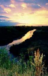
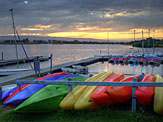
San Leandro Marsh
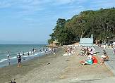
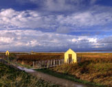
Coyote Point Beach

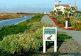
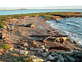
Coyote Hills
 The
San Francisco Bay Trail is a proposed 500-mile
network of trails around the shores of San Francisco Bay. The Bay Trail
runs through the 9 counties that surround the Bay. Over 340 miles of
the
trail have been completed. (See here for Bay Trail General
Facts.) The trails run along the bayshore, salt ponds,
creeks and sloughs, and marshes. The trails are ideal for biking,
walking,
jogging, nature-watching, and other activities. The trails are mostly
flat, so are suitable for people of all physical abilities. The trail
surfaces
range
from gravel roads, dirt levees, to paved landscaped paths. The paved
paths
are suitable for roller skates, baby strollers, and wheelchairs.
The
environments
range
from enormous lonely salt ponds, to popular developed parks, to narrow
paths near busy streets and commercial areas. Wildlife abounds,
particularly
waterfowl. These are excellent places for bird-watching. Ducks, geese,
herons, egrets, pelicans, gulls, marsh hawks, cormorants, and
shorebirds abound in these areas. Two endangered
species make their homes in the pickleweed marshes along the Bay: the
clapper (now Ridgway's)
rail and the salt marsh harvest mouse.
Near the airports, the Bay
Trail
is an ideal area for watching manmade birds land and take off.
Access
to the Bay also makes the shorelines along the Bay Trail popular places
for water sports such as fishing, swimming, and wind surfing. There are
many public parks and recreational facilties along the trail, as well
as
homes, businesses, hotels, restaurants, and stores. The trail can be
used for
travelling
to recreational spots, going to shop or eat, or even commuting to work.
These activities will become even more possible once the entire Bay
Trail
is complete. With the public
purchase of the
Cargill salt ponds in the South Bay, even more trails are possible.
I've been biking around the southern Bay Trails. I've taken pictures of the scenery and made notes on the routes. My goal is to cover the Bay Trail from San Francisco International Airport, down the Peninsula, around the South Bay, and up the East Bay to Oakland International Airport. Here are the Bay Trail pages I've developed or am working on. They include the main trunk of the Bay Trail as well as feeder trails. The oldest pages are on my Bay Area Biking pages. From 1998 to around 2003, I created guided photo tours for the Bay Trail Project, which were hosted on their website and include trail descriptions. Those pages are marked with * below. The pages made before 2001 have pictures taken with film cameras and scanned from prints at low resolution. Starting from the end of 2001, I started taking pictures with digital cameras and posted pictures at higher resolution. The more recent webpages, starting in 2007, are hosted on my website, rhorii.com. Some of the latest pictures are on Facebook albums. The webpages are listed below in geographic order, from north to south. The Facebook pages are in chronological order. All of these pages were developed strictly as a volunteer effort. If you would like to use any of these pictures, contact me.
My intent for doing these tours and pictures is to promote increased awareness and appreciation for the Bay Trail. Hopefully, as the Bay Trail brings more people in contact with the Bay, it will result in more support for preserving and restoring the Bay itself and its natural resources. Public and private support is needed to complete the Bay Trail. It is becoming one of the nations's truly great trail systems and will be a treasure for the Bay Area for years to come.
Update
2016: Note that my original Bay Trail guided photo tours are no longer
available on the Bay Trail's website. They are available on the Internet Archive.
The links below have been updated to point to the archived copies. Note
that the internal page-to-page links, as well as many of the other
links, on those pages may not work. These are archived copies, so I
have no way to update them.


Redwood Shores
Shoreline at Mountain View
Alviso Marina

Burlingame

Palo Alto Baylands
Hayward Shoreline

Foster City

Bay Farm Island, Alameda